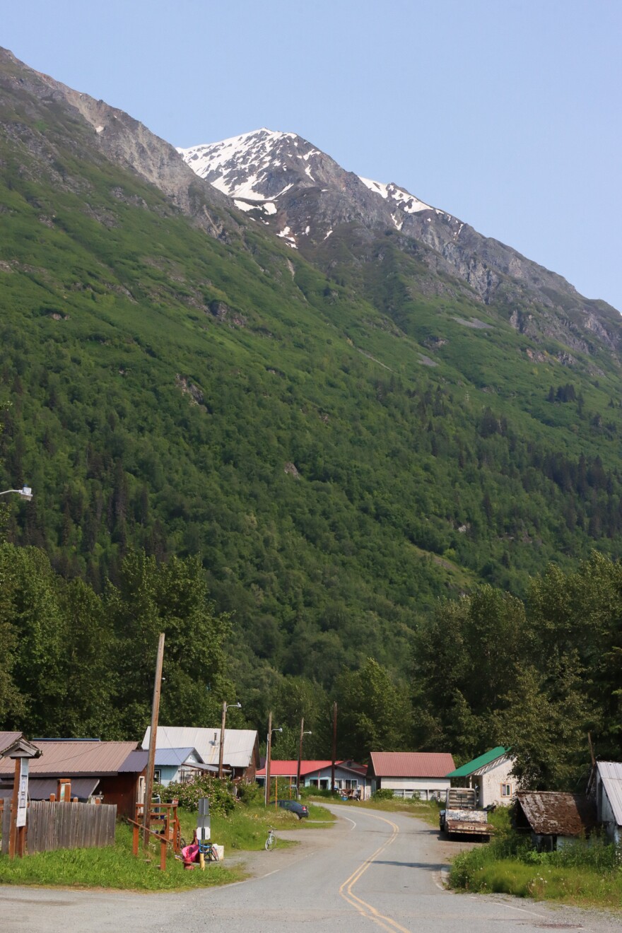
Decades ago in the Chilkat Valley, heavy rains would spark mudflows that tumbled down the Takshanuk Mountains, over an international highway and into the Native village of Klukwan.
Dan Hotch remembers it well. The slides in the late twentieth century that flooded and damaged buildings would routinely deposit a slurry of rocks and mud under his family’s home.
“Growing up as a kid, we hated August and September weather because we knew the rains were coming, and we knew the water was coming down. And there was no way to really stop it,” said Hotch, who is now an environmental specialist with the Chilkat Indian Village.
Then, about 25 years ago, a community member built a berm high in the foothills to divert the debris down another slide path and away from the village.
For decades, it worked. But now that’s starting to change. As the slide path evolves and sediment builds up, rocks and mud have started surging out of that channel – and heading in a concerning direction.
“That migration has caused it to start to point debris flows more towards the village again,” said Josh Roering, an Oregon-based geologist researching geohazards across Southeast Alaska.
The situation has major implications for the village’s safety – and long-term future.
The tribe wants to build more housing not only for current residents, which the 2020 census put at 87 people, but also to make it possible for tribal members who don’t live in the village to move there.
But that’s complicated by the fact that Klukwan is sandwiched between two geohazards that are intensifying with climate change: to the east, landslides from the Takshanuks, and to the west, erosion and flooding from the Chilkat and Tsirku Rivers.

“With these extreme high temps in the summers, and then the atmospheric rivers in the fall and winters, a lot more flooding is happening here,” said Jess Kayser Forster, who has consulted for the Chilkat Indian Village on environmental issues for more than a decade.
That means the village has two options for development: further north, up the valley, or east, across the highway and into the foothills — which would mean building in areas with intensifying landslide risk.
In response, the tribe has joined a region-wide research project to better understand the threat and develop accordingly.
“It’s kind of hard to expand this way if we wanted to, knowing the fact that [mudflows] could come and take out everything that you’re trying to do,” Hotch said.
Studying the risk
It’s an issue playing out across the region, state, country and world. Communities are expanding into wilderness at the same time as rising temperatures are fueling less predictable and more severe wildfires, floods and landslides.
That has triggered a global reckoning over how to model extreme weather, protect communities and develop new ones without putting more people in harm’s way.
“You can see it all over Southeast Alaska, my home included,” Kayser Forster said. “We’re all built in these areas where these hazards are.”
That reality is top of mind in Klukwan. In 2018, the tribal council kicked off a climate resilience planning process. Then, in 2020, an atmospheric river triggered a devastating landslide that killed two community members in Haines.

“We realized that we were underprepared if an event like that were to happen in Klukwan. It highlighted a lot of our needs, and a lot of our risks. But it also highlighted the community’s desire to build those capacities,” said Shawna Hotch, who serves as the tribal liaison for Klukwan’s Tribal Emergency Operations Center.
By 2022, the village had joined a regional research project that aims to help tribal governments to do just that.
The effort is called the Ḵutí Project, which means “weather” in Tlingit. The project, which is run out of the Sitka Sound Science Center using a five-year federal grant, is fueling research in Klukwan, Skagway, Hoonah, Yakutat, Craig and Kasaan.
The main goal is to ensure communities have the data and tools they need to grapple with – and prepare for – weather events that are typically sparked by heavy rains. Roering, the University of Oregon-based researcher, emphasized that the geography, geology and risk are unique in each community. That means on-the-ground research is, too.
Planning for the future in a changing landscape
Klukwan, for its part, sits in the shadow of fractured cliffs further weakened by rain, frost and snow that are crumbling into a catchment below. During heavy rains, water and gravity carry the material downhill.
“When the debris flows get too big to stay in the current channel, they’ll do what’s called an avulsion,” Roering said. “That means they basically jump out of the banks, go over the banks, and follow a new path.”

Particularly interesting is that state geologists have recently discovered permafrosthigh up on those mountains. Roering said it’s too soon to say whether melting permafrost – another climate impact – could be contributing to instability. But research in other parts of the world suggests it’s possible.
Studying and addressing those processes has taken several forms. First, the project is funding the installation of a brand-new weather station, to ensure more accurate local forecasting.
The project has also funded lidar collection and analysis, which provides insight into existing slidepaths and how they’re changing. Finally, it made possible the installation of cameras and sensors high up in the mountains.
On a recent field visit to Klukwan, Roering walked through a dense patch of forest, and pointed them out.
“These are called infrasound sensors,” he said. “They’re recording things that we are not hearing but are happening in the environment.
Think: wind, rain and rockfall. That data, combined with camera footage, provides crucial context about what triggers rockfalls and mudflows, and when those flows are more likely to avulse out of the main channel – and potentially surge toward the village.
For now, Roering said the goal is to develop a baseline of what exactly is happening on the hillside, and why. But even that is complicated.
“This is going to be a long term project,” Roering said. “That channel is going to keep changing, regardless of a berm that gets built next summer, or the summer after.”
Even so, the tribe will ideally be able to use the information for a few purposes. First, planning new berms to divert the slides away from the village, and supporting grant applications to fund the work.
And second is safe community development. Hotch, of the tribe’s environmental staff, said that could encourage tribal members to move home. He himself moved back to Klukwan about a decade ago after spending years in Oregon, first for boarding school and later for work.
“It’s great to be home,” he said. “We need more people back at home.”


